Tanker burning south of Larak Island, Strait of Hormuz
Strait of Hormuz, about 6 nautical miles south of Larak Island
Snapshots are curated, event-dated observations from open satellite data. They document specific events; they are not the systematic instrument records above. Every image carries its provenance in-frame.
Caption
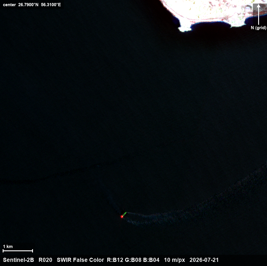
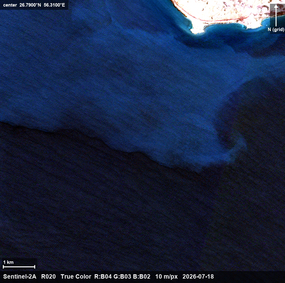
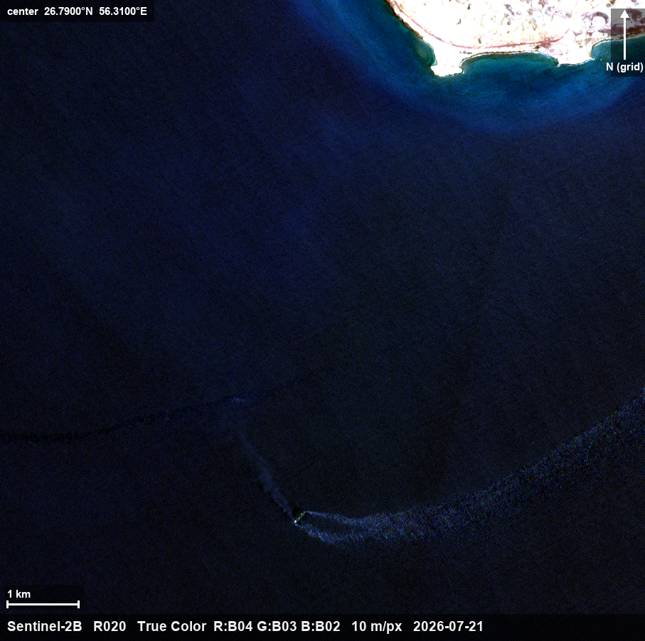
Sentinel-2 shortwave-infrared image, 21 July 2026, 06:46 UTC: a tanker burning about 6 nautical miles south of Larak Island, on the Iranian side of the Strait of Hormuz — the bright point is the active fire; the dark trail running northwest is smoke, and a surface discharge spreads several kilometers from the hull. The same water was clear on the 18 July pass. The vessel, roughly 200–250 m, has not been identified, and no reported incident matches this position. Imagery: Copernicus Sentinel-2 (open data) via Microsoft Planetary Computer, rendered and annotated by NewsplanetAI.
What this imagery does not establish
The vessel's identity is not established — nothing in these pixels reads a name, and no reported incident matches this position. The imagery establishes neither an attacker nor a mechanism. The dark spread is a surface discharge; its composition (oil, fuel, or other film) is not proven by optical imagery. The position is where the vessel was at the moment of the pass, not where it is now.