← Observatory
Snapshot · observed July 6, 2026, 06:46 UTC

Tanker activity at the Kuh-e Mobarak SPM field, Jask export terminal

Kuh-e Mobarak, Hormozgan Province, Iran — Gulf of Oman coast, ~65 km west of Jask

Snapshots are curated, event-dated observations from open satellite data. They document specific events; they are not the systematic instrument records above. Every image carries its provenance in-frame.
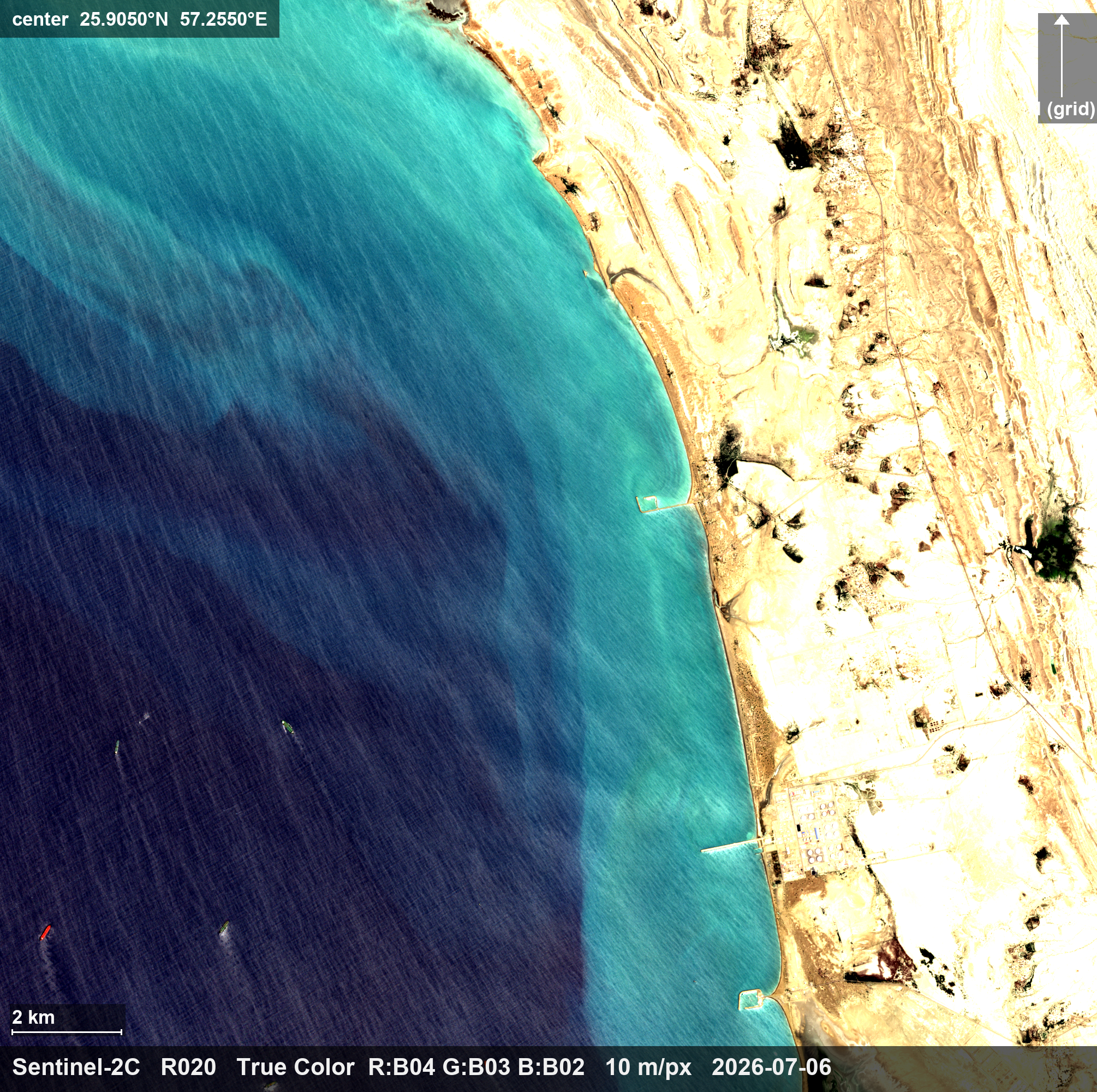
Tanker activity at the Kuh-e Mobarak SPM field, Jask export terminal — 6 July, wide view — the shore terminal and pier (lower right), the coast, and the western mooring field with one hull on station (lower left)
6 July, wide view — the shore terminal and pier (lower right), the coast, and the western mooring field with one hull on station (lower left) · true color · 10 m/px · open full resolution ↗
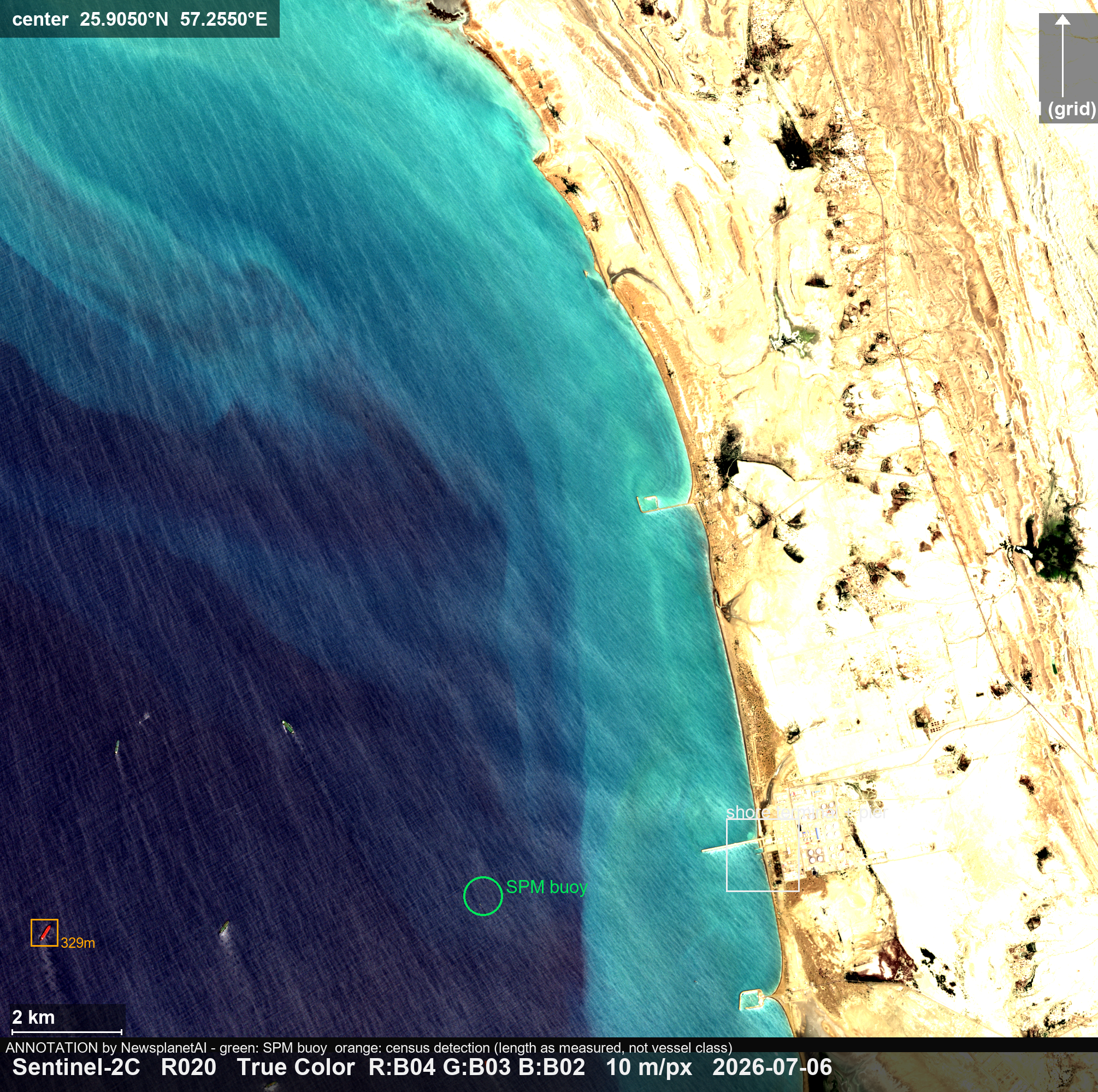
Tanker activity at the Kuh-e Mobarak SPM field, Jask export terminal — 6 July, wide view annotated — shore terminal, SPM buoy position, and the westernmost hull
6 July, wide view annotated — shore terminal, SPM buoy position, and the westernmost hull · true color + annotation · 10 m/px · open full resolution ↗
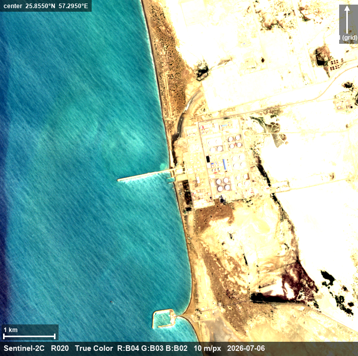
Tanker activity at the Kuh-e Mobarak SPM field, Jask export terminal — 6 July, terminal close-up — tank structures in two groups, a ~1 km trestle pier (no vessel alongside on this pass), and a small breakwater harbor
6 July, terminal close-up — tank structures in two groups, a ~1 km trestle pier (no vessel alongside on this pass), and a small breakwater harbor · true color · 10 m/px · open full resolution ↗
Tanker activity at the Kuh-e Mobarak SPM field, Jask export terminal — 30 December 2025, same window as the July frames below — the wider mooring field on that date, for direct comparison
30 December 2025, same window as the July frames below — the wider mooring field on that date, for direct comparison · true color · 10 m/px · open full resolution ↗
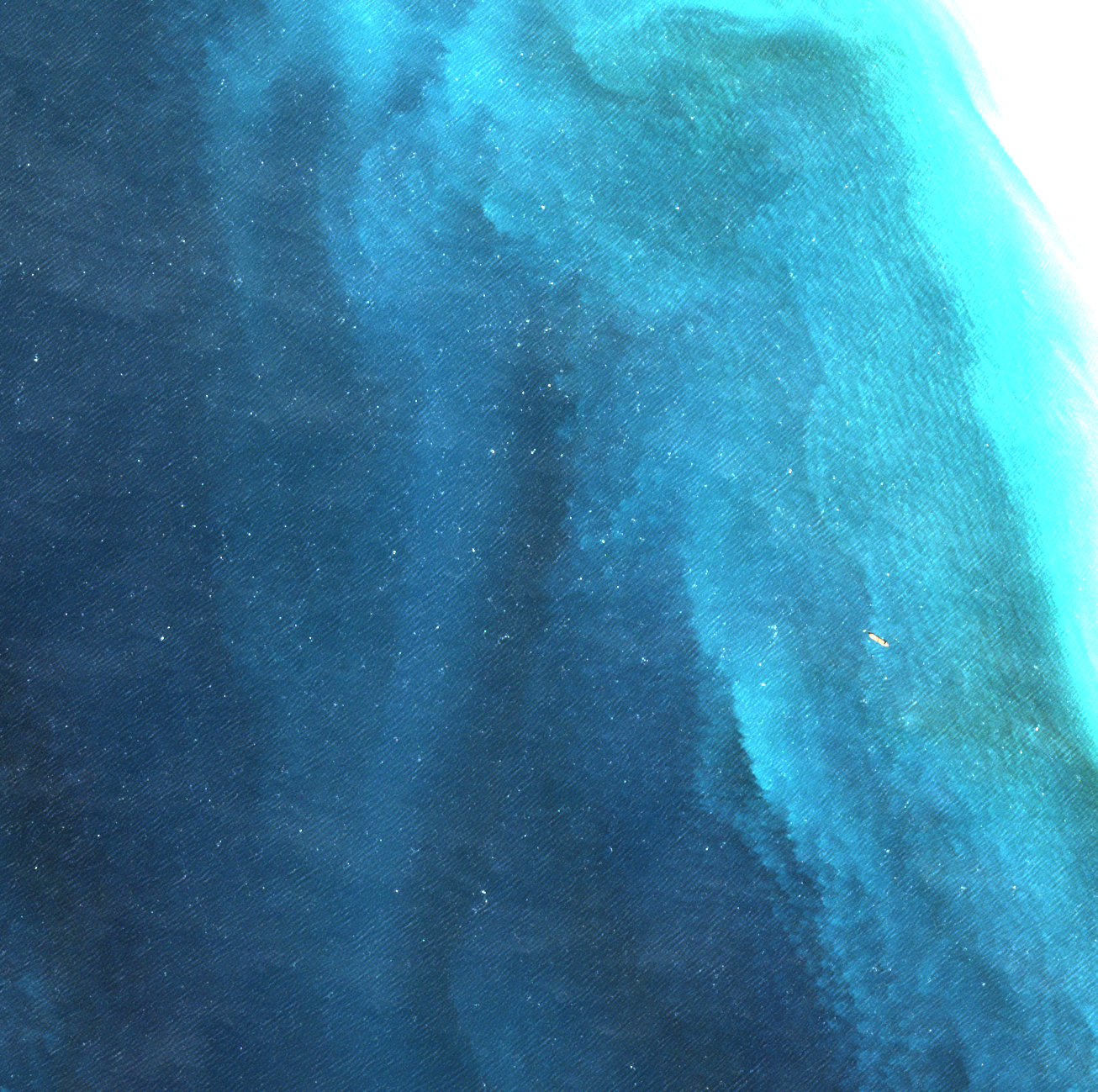
Tanker activity at the Kuh-e Mobarak SPM field, Jask export terminal — 30 December 2025, close view — a single hull (~280 m as measured at 10 m/px) moored at the SPM buoy, months before the war. The terminal was working then
30 December 2025, close view — a single hull (~280 m as measured at 10 m/px) moored at the SPM buoy, months before the war. The terminal was working then · true color · 10 m/px · open full resolution ↗
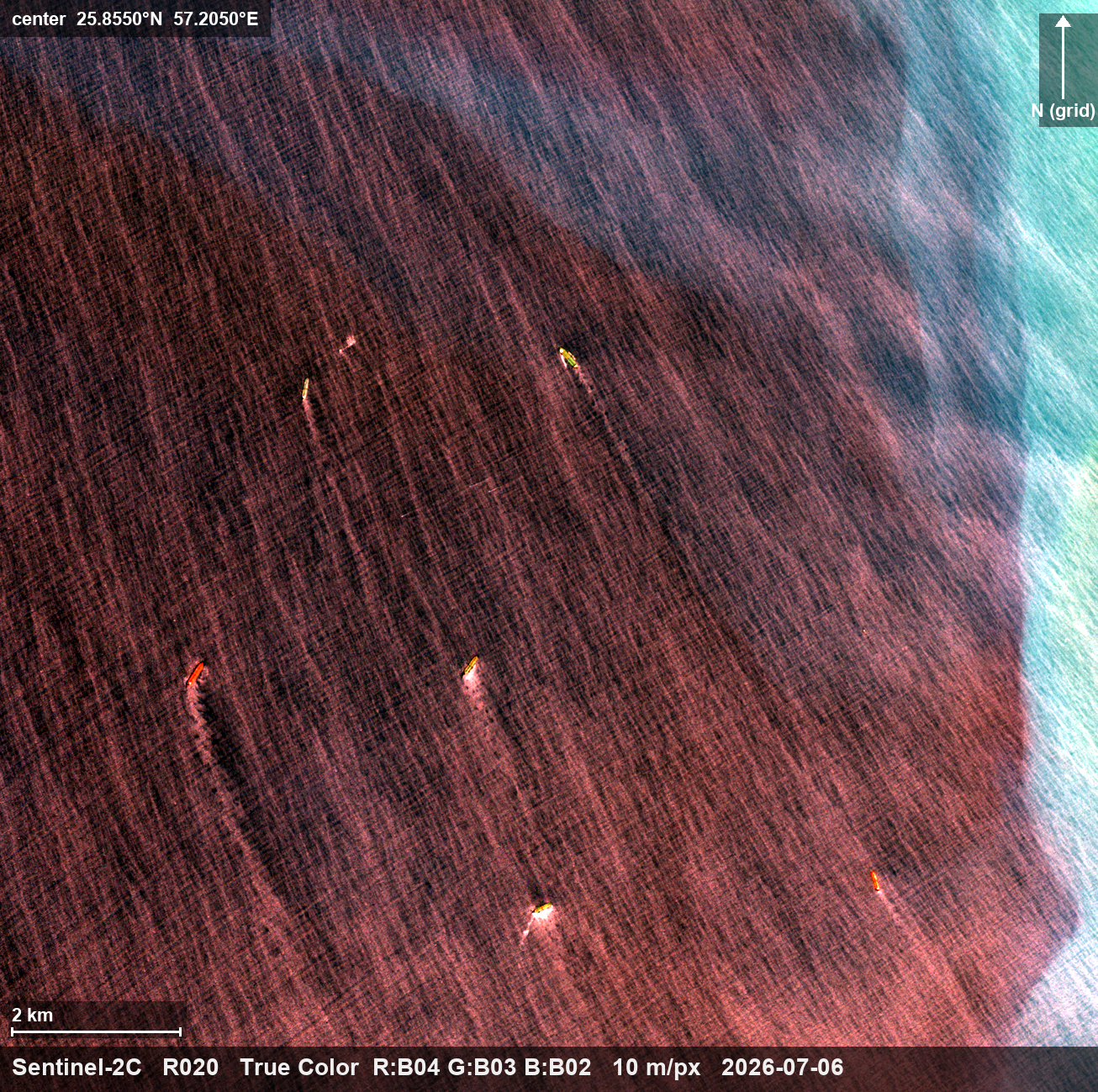
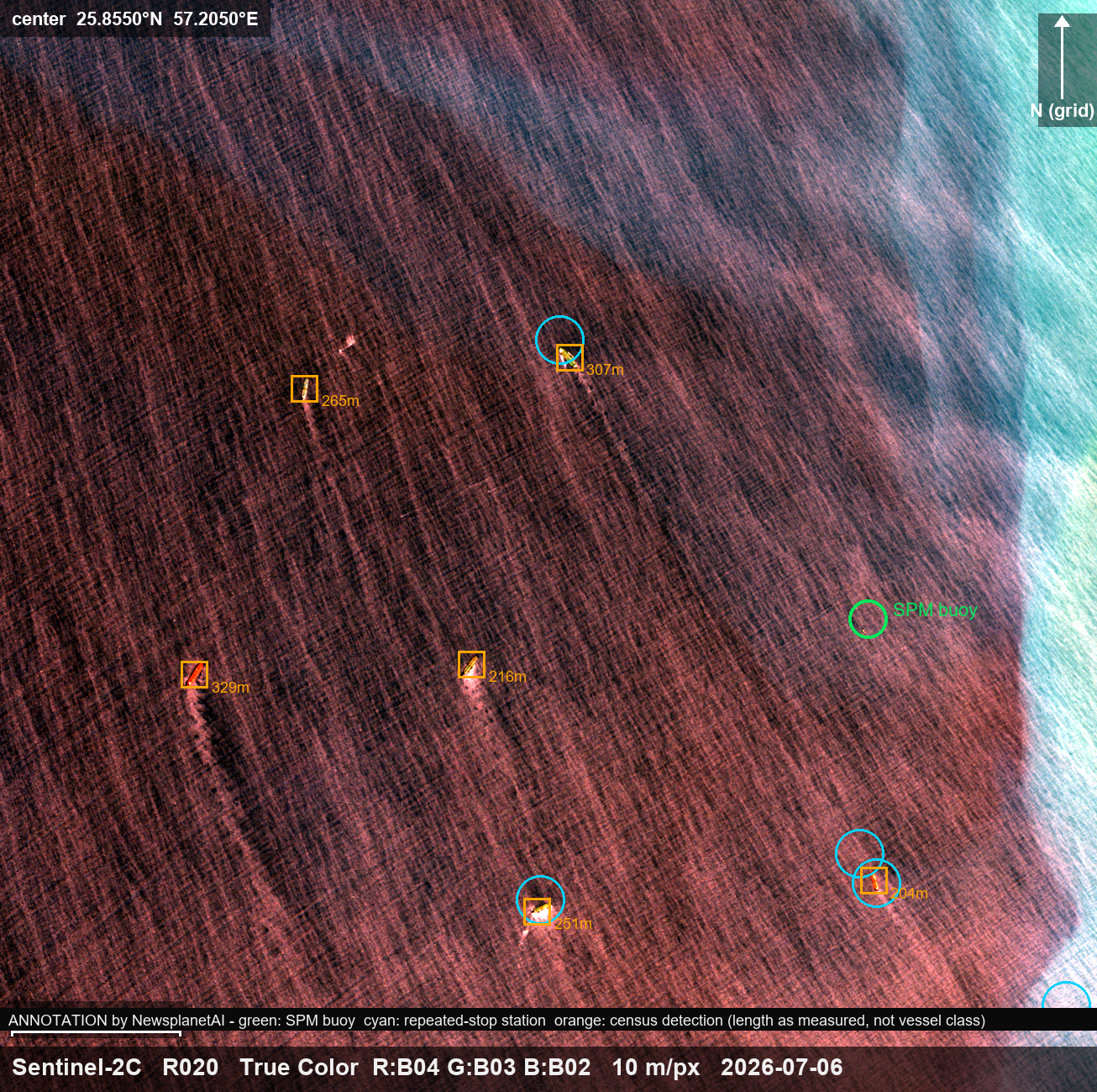
Tanker activity at the Kuh-e Mobarak SPM field, Jask export terminal — 6 July — the offshore mooring field: six large hulls (204-329 m as measured) hold positions 3-8 km from the SPM buoy; the buoy itself is unoccupied
6 July — the offshore mooring field: six large hulls (204-329 m as measured) hold positions 3-8 km from the SPM buoy; the buoy itself is unoccupied · true color · 10 m/px · open full resolution ↗
Tanker activity at the Kuh-e Mobarak SPM field, Jask export terminal — 6 July, annotated — green: SPM buoy; cyan: positions where large hulls have stopped repeatedly since late May 2026; orange: hulls detected on this pass
6 July, annotated — green: SPM buoy; cyan: positions where large hulls have stopped repeatedly since late May 2026; orange: hulls detected on this pass · true color + annotation · 10 m/px · open full resolution ↗
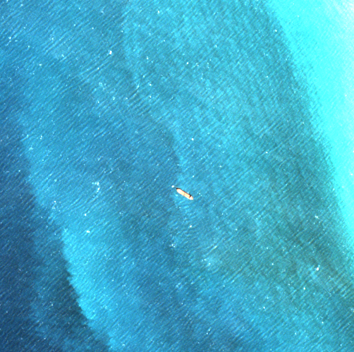
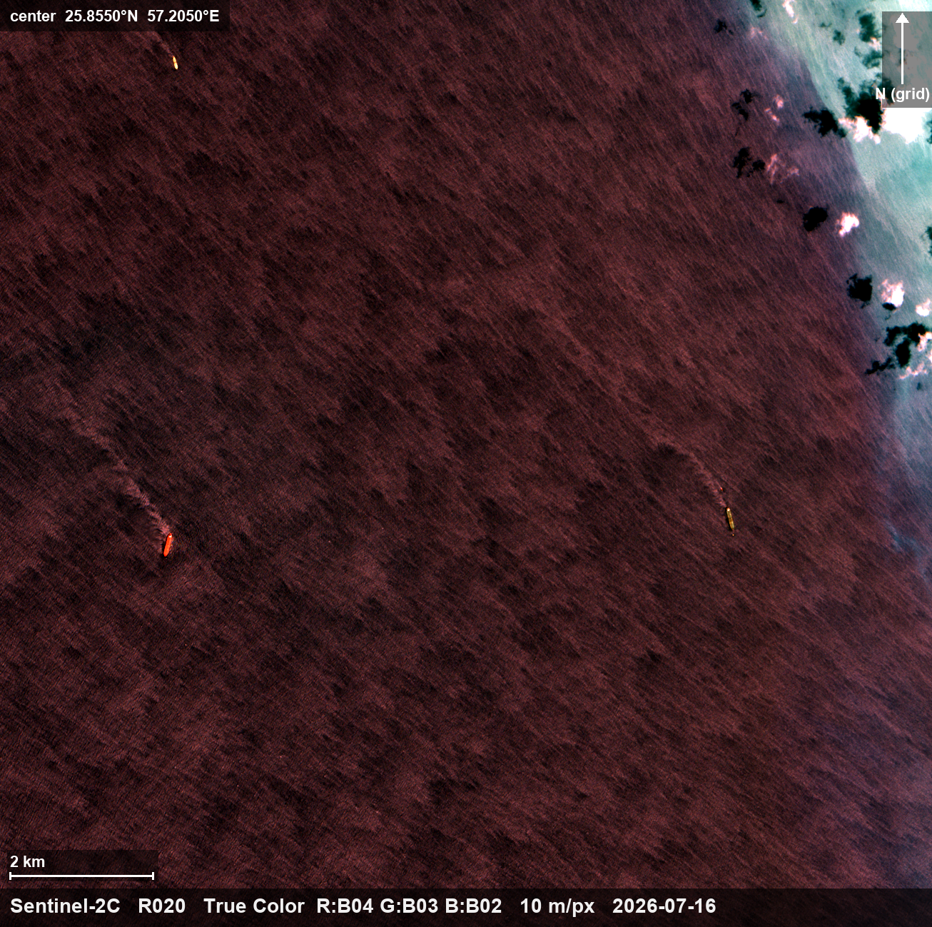
Tanker activity at the Kuh-e Mobarak SPM field, Jask export terminal — 16 July — a ~300 m-class hull moored at the SPM buoy; the surrounding field positions are empty on this pass
16 July — a ~300 m-class hull moored at the SPM buoy; the surrounding field positions are empty on this pass · true color · 10 m/px · open full resolution ↗
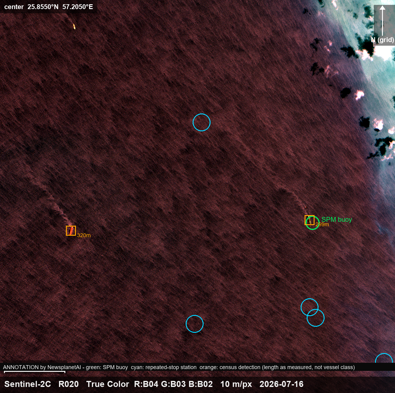
Tanker activity at the Kuh-e Mobarak SPM field, Jask export terminal — 16 July, annotated — the hull at the buoy position (green), one 320 m hull remaining west
16 July, annotated — the hull at the buoy position (green), one 320 m hull remaining west · true color + annotation · 10 m/px · open full resolution ↗

Caption

Sentinel-2 images, December 2025 and July 2026: the Kuh-e Mobarak single-point-mooring (SPM) field on Iran's Gulf of Oman coast — the seaward end of the Goreh-Jask pipeline, Iran's documented crude export route, and the only one that reaches open water without passing through the Strait of Hormuz. Tankers were working this terminal before the war and are working it now. On 30 December 2025 a hull of about 280 m, as measured at 10 m/px, lay moored at the SPM buoy. On 6 July 2026 six large hulls (204-329 m as measured) held positions 3-8 km from the buoy while the buoy itself sat empty; several of those positions have seen repeated stops by large hulls since late May 2026. On 16 July a ~300 m-class hull was moored at the buoy and the surrounding positions were empty. The shore terminal — tank structures, a ~1 km trestle pier, a service harbor — sits on the coast about 5 km east of the buoy. Imagery: Copernicus Sentinel-2 (open data) via Microsoft Planetary Computer, rendered and annotated by NewsplanetAI.

What this imagery does not establish

These images show positions and postures, not transfers: a hull moored at an SPM buoy is observed mooring, and whether it loaded, discharged, or merely moored is not observable in optical imagery — nor is any cargo, origin, or destination. Hull lengths are as measured at 10 m/px and carry pixel-scale uncertainty; no vessel is identified — nothing in these pixels reads a name or flag. The repeated-stop positions are pattern-of-life observations from the same public imagery archive, not tracking data. Whether the offshore hulls are queuing, storing, or anchored for any other purpose is not established. The December 2025 and July 2026 frames establish that hulls were working this terminal on both dates — that is time depth, not a rate. This page makes no claim about how often the buoy is occupied, and none should be read from three dates a year apart.

Source: Copernicus Sentinel-2 L2A (open data) via Microsoft Planetary Computer. Rendered and annotated by NewsplanetAI. Published 2026-07-25. This page is not edited after publication; corrections append above.

Scene identifiers
  • S2A_MSIL2A_20251230T065331_R020_T40REP_20251230T094613
  • S2C_MSIL2A_20260706T064621_R020_T40REP_20260706T115722
  • S2C_MSIL2A_20260716T064621_R020_T40REP_20260716T115112