Kerch Strait: a full anchorage, then empty water — June–July 2026
Kerch Strait — the Azov–Black Sea passage between Crimea and the Taman Peninsula; all Rostov, Taganrog, Yeysk and Temryuk traffic transits one navigable bridge span
Snapshots are curated, event-dated observations from open satellite data. They document specific events; they are not the systematic instrument records above. Every image carries its provenance in-frame.
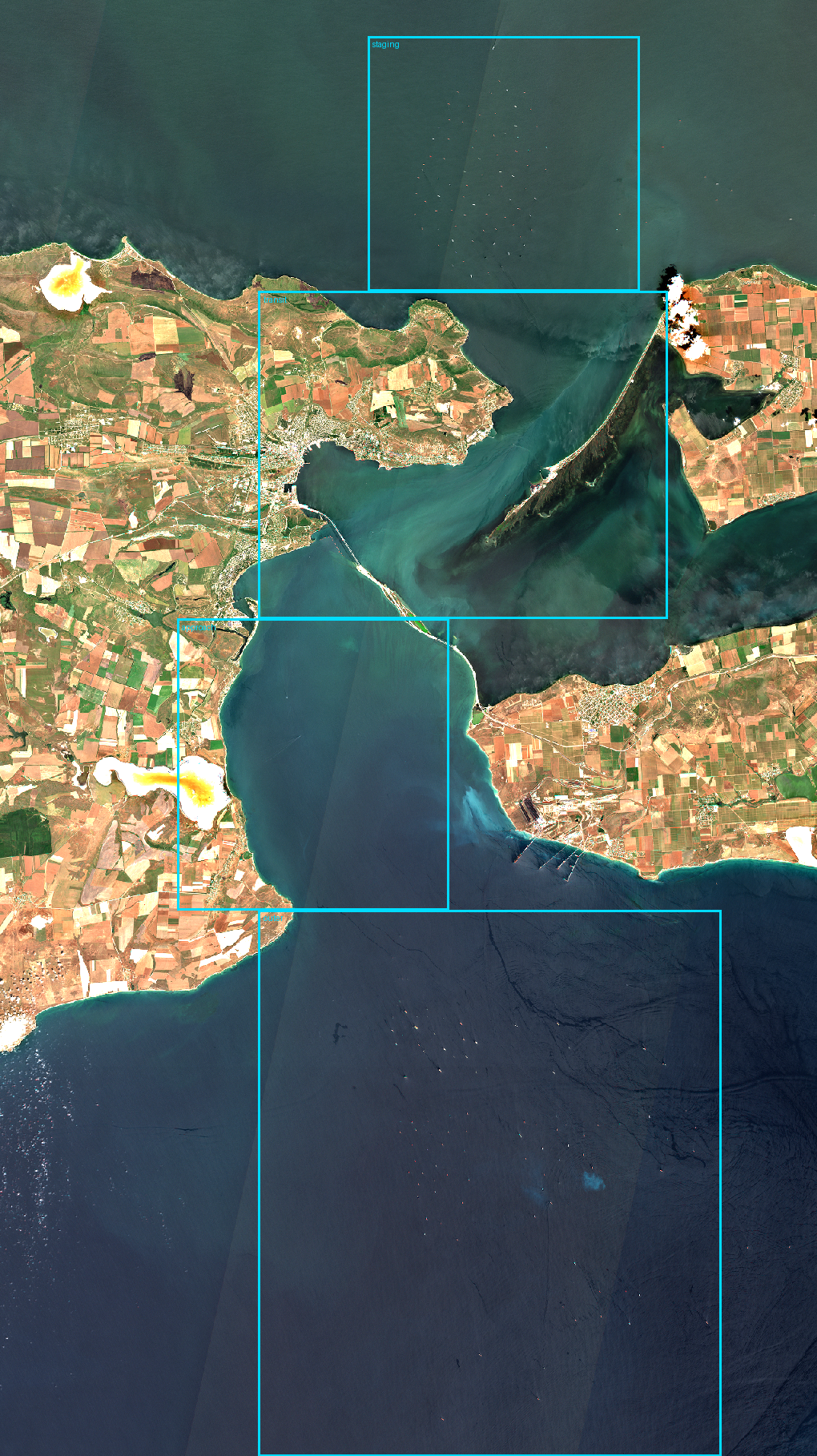
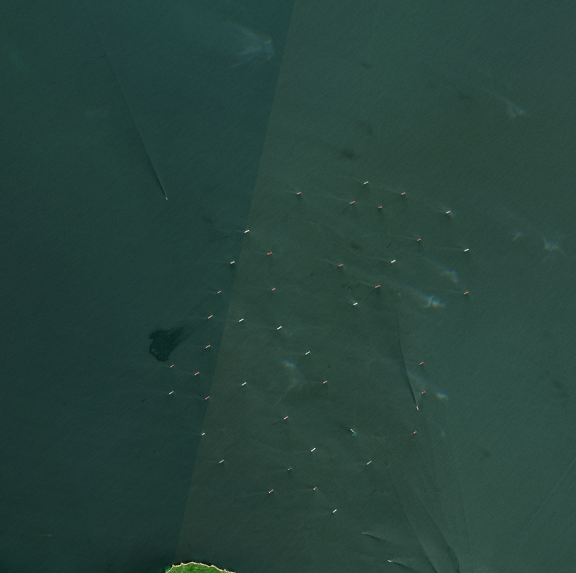
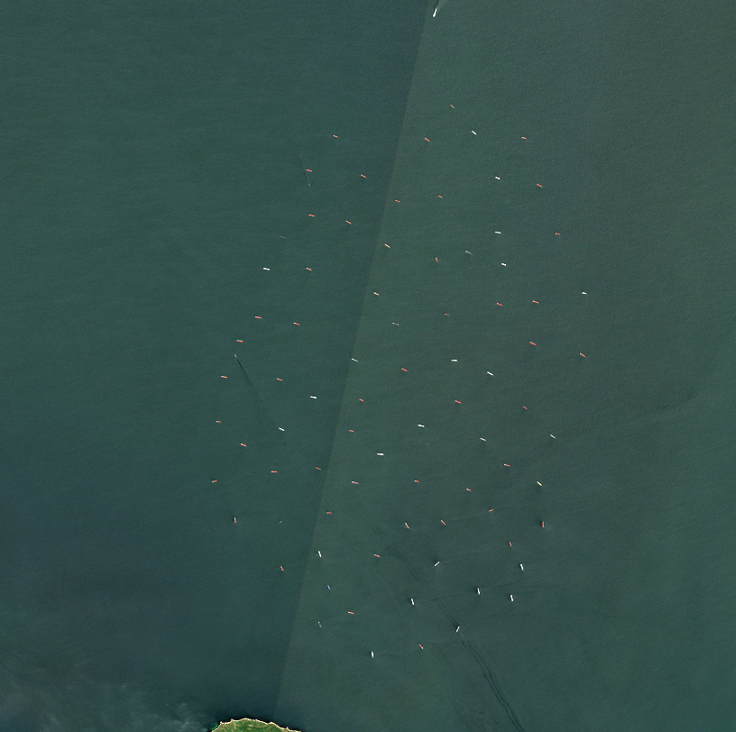
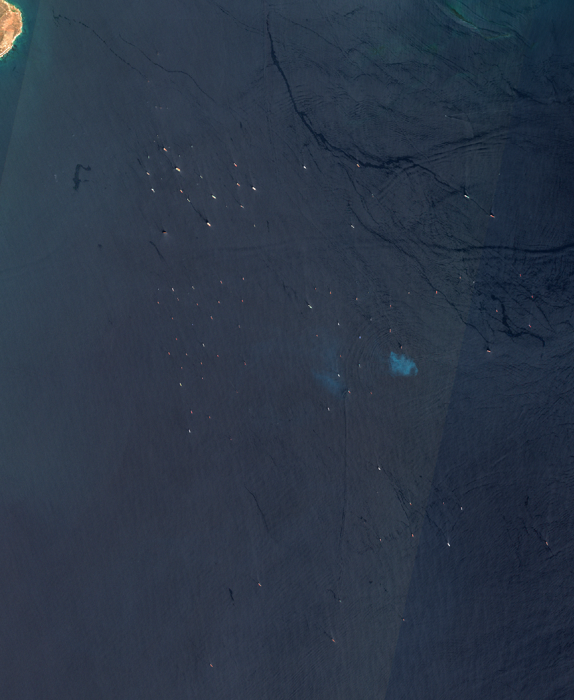
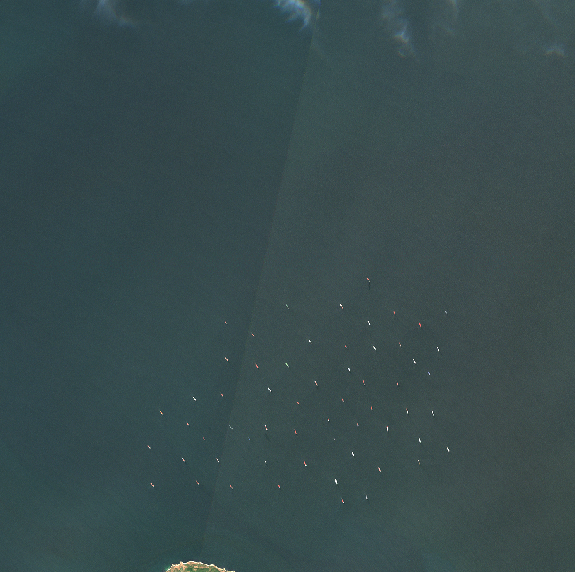
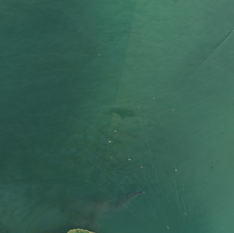
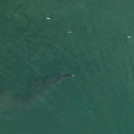
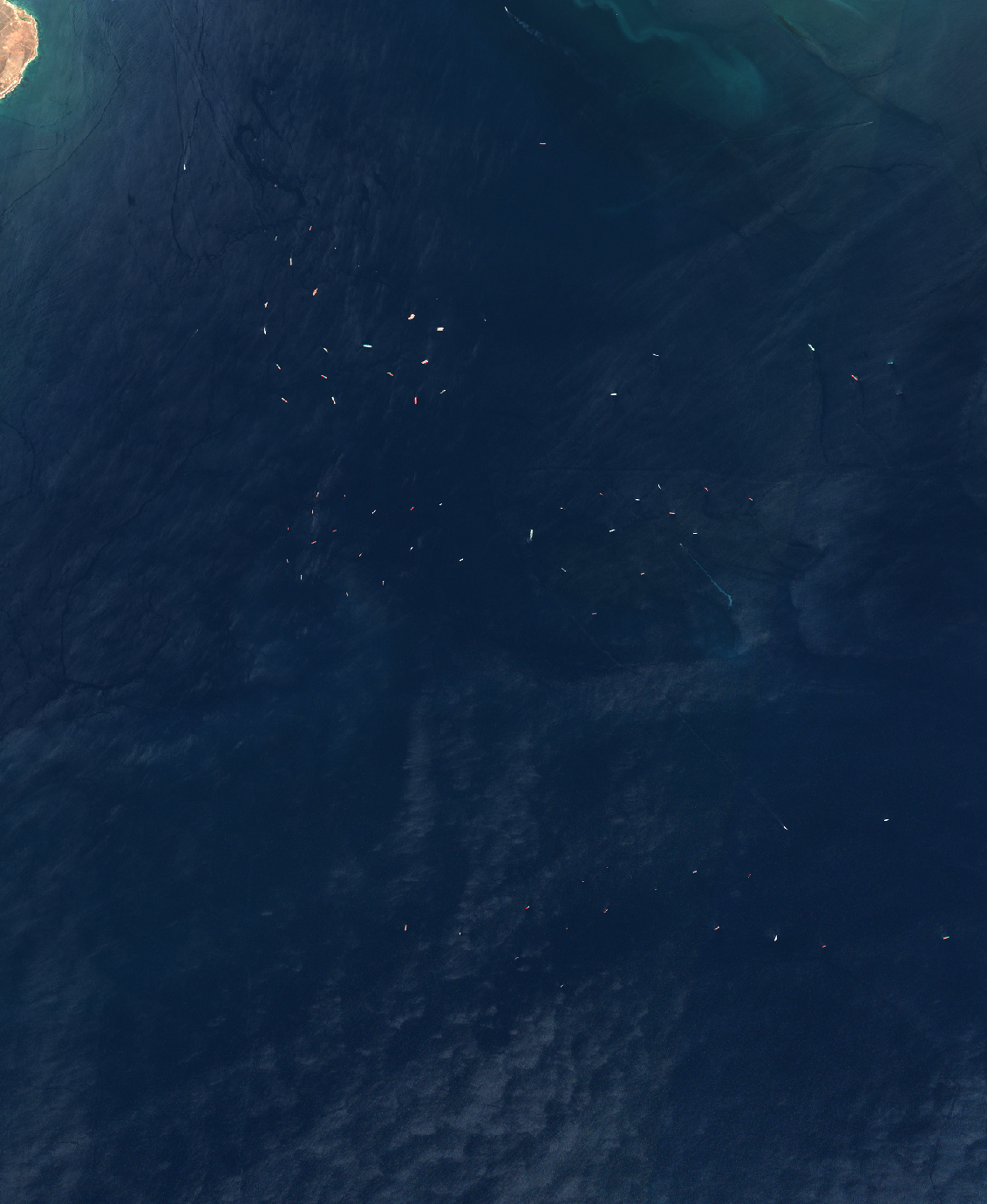
Where we are looking. The whole corridor on 1 July 2026 — Crimea to the west, the Taman Peninsula to the east, the Sea of Azov above, the Black Sea below, and the single navigable bridge span between them. The four boxes are the areas counted on every later frame: from the top, the Azov-side waiting area, the span passage, the lane south of it, and the Black Sea-side stack. Ships are visible inside the top and bottom boxes on this date · true color + zone overlay · 50 m/px · open full resolution ↗6 June 2026 — the Azov-side waiting area on a clear day. A typical, not a peak, day: 38 hulls of 100 m or longer, machine-counted · true color · 20 m/px · open full resolution ↗1 July 2026 — the same water, the same frame, at its fullest: 83 detections, 81 of them 100 m or longer, machine-counted. Nine days before the strait closed to shipping · true color · 20 m/px · open full resolution ↗1 July 2026, radar — the same anchorage seen by Sentinel-1 at 15:27 UTC, roughly 80 bright hard targets. An independent sensor, sharing no failure mode with the optical frame above · SAR VV, gamma0 -30 to -10 dB · 20 m/px · open full resolution ↗1 July 2026 — the Black Sea side, south of the strait. Vessels that clear the passage southbound stack here in the same loose pattern: 88 hulls of 100 m or longer, machine-counted · true color · 25 m/px · open full resolution ↗26 July 2025 — the same Azov-side frame in the same calendar weeks a year earlier, anchorage full (54 hulls of 100 m or longer, machine-counted). July is not a quiet month here · true color · 20 m/px · open full resolution ↗8 July 2026 — vessels under way, wakes fanning north out of the strait mouth. Haze reduces what this pass can show, so it is offered as evidence of movement only, never of absence · true color · 20 m/px · open full resolution ↗8 July 2026, close view at 10 m — a compact bright source over water at approximately 45.465 N, 36.638 E with a large plume trailing southwest. Two days before the closure order. See the separate boundary note in the caption · true color · 10 m/px · open full resolution ↗12 July 2026, radar — the Azov-side anchorage about 36 hours after the strait closed to shipping. Empty water; a single bright return remains. Radar because the optical pass that week could not see the surface · SAR VV, gamma0 -30 to -10 dB · 20 m/px · open full resolution ↗11 July 2026 — the Black Sea side on a genuinely clear southern pass, still holding roughly 67 hulls of 100 m or longer while the Azov side had already emptied. The far side drained second · true color · 25 m/px · open full resolution ↗18 July 2026, radar — the Azov-side anchorage, empty · SAR VV, gamma0 -30 to -10 dB · 20 m/px · open full resolution ↗24 July 2026, radar — the most recent pass available at publication. The Azov-side anchorage is still empty, thirteen days after the closure · SAR VV, gamma0 -30 to -10 dB · 20 m/px · open full resolution ↗24 July 2026, radar — the Black Sea side on the same pass, also empty. The bright diagonal boundary is a wind front on the sea surface, not a scene edge · SAR VV, gamma0 -30 to -10 dB · 25 m/px · open full resolution ↗
Caption
Sentinel-2 and Sentinel-1 images, July 2025 to 24 July 2026: the waiting areas either side of the Kerch Strait, the single passage between the Sea of Azov and the Black Sea. Through the first days of July 2026 both sides carried a large anchored population — 81 hulls of 100 m or longer on the Azov side on 1 July, 88 on the Black Sea side, machine-counted from the imagery. Russia's FSB Border Service stopped accepting applications to transit the strait at 18:10 local on 10 July 2026, following a Ukrainian drone campaign against shipping in the Sea of Azov (external reporting; the imagery establishes dates and presence, not cause). By 12 July the Azov-side anchorage was empty; the Black Sea side, still holding roughly 67 hulls on 11 July, had emptied by 18 July. Both remain empty on 24 July, the most recent pass available. The same frame in the same calendar weeks of 2025 shows a full anchorage, so this is not a seasonal lull. Counts throughout are machine counts read off the imagery — they indicate scale, not exact quantity. Imagery: Copernicus Sentinel-2 and Sentinel-1 (open data) via Microsoft Planetary Computer, rendered by NewsplanetAI.
What this imagery does not establish
This is a record of a bounded period, not a standing measurement, and traffic is expected to resume. It shows vessels present or absent in two named boxes on named dates — nothing more. The counts are machine counts with no audit and no error bands; they indicate scale and are not findings in themselves. Nothing here identifies any vessel: no name, flag, owner, operator, cargo, origin or destination is readable in this imagery, and this traffic is largely dark to public tracking by construction. The imagery does not establish cause — the closure order and the drone campaign are external reporting, and pixels can show when water emptied but not why. It does not say the strait is closed; it says no vessels were observed in these boxes on these dates. The first frame shows four areas of the corridor; only the two named above carry counts on this page, and the other two are shown for orientation. Vessels much below 100 m sit at or under the resolution floor. Optical passes on 6, 11, 16 and 18 July were obscured by haze the cloud classifier did not flag; their counts happen to agree with everything above and are excluded anyway, because a pass that cannot see the water is not evidence of empty water. Radar is not immune either — wind-roughened sea is bright, and a wind front is visible on the 24 July view. The two sensors pass at different times of day, so their agreement on 1 July concerns anchorage occupancy, where hulls persist for days, and would not be valid for instantaneous transit. On the 8 July plume specifically: a point source was burning over water on that date. Not whose, not what type of vessel, not the cause, and not connected here to any named event.